BOP Rotorua Heavy Rain Warning: MetService Alert Levels Explained
Anyone who lives in Rotorua knows the quickest way to read the sky is the bay’s radar. On the morning of 13 October 2026 the official picture was quiet — patchy drizzle, a high near 19°C, and no active orange warning — but earlier in 2026 heavy rain watches and warnings swept parts of the Bay of Plenty, so it helps to understand what each alert level means before the next big downpour lands.
MetService warning threshold: 50mm in 6h or 100mm in 24h ·
BOP Orange Warning rain (Jun 2026): 90–130mm additional ·
Peak downpour rate: 25–40mm/h ·
Rotorua rain on 13 Oct 2026: 0.7mm ·
Rotorua active warning: none at last check
Quick snapshot
MetService’s Rotorua forecast on 13 October 2026 showed no active Orange or Red warning; severe rainfall warning criteria start at more than 50mm in six hours or 100mm in 24 hours across 1,000km² or more; and a June 2026 Orange Warning for parts of the region forecast 90–130mm of additional rain (MetService, New Zealand’s national weather authority).
Whether a black rainfall warning would ever be issued in New Zealand — MetService currently uses only Orange and Red tiers — plus the exact calendar dates of the community-reported “Thursday and Friday” Rotorua heavy rain warning, and whether a yellow alert is active at the moment you read this; alert status changes quickly (MetService warnings).
Feb 2026: an 11-hour heavy rain watch covered Bay of Plenty from 2pm Friday to 1am Saturday; June 2026: Orange Warning for Bay of Plenty east of Whakatane and parts of Gisborne/Tairāwhiti ranges; 13 Oct 2026: Rotorua forecast page shows quiet conditions, no active warning (MetService warnings, MetService Rotorua forecast).
Check MetService’s live warnings page before travel or outdoor plans, monitor the Rotorua 7-day forecast for any shift toward heavy rain, and if an Orange or Red warning appears, follow the advice: clear drains, avoid low-lying areas, and drive cautiously (MetService warnings, MetService Rotorua forecast).
One pattern stands out across the warning data: Bay of Plenty’s flood risk isn’t only about hourly intensity — it’s built on 24-hour totals. Here’s how the numbers line up.
| Warning / metric | Value | Basis |
|---|---|---|
| MetService heavy rain watch | 11-hour watch, 2pm Friday to 1am Saturday (BOP, Feb 2026) | MetService warnings |
| Hourly rainfall in warnings | 25–40mm per hour at peak | MetService warning statement |
| Orange warning total | 100–150mm in 24h, up to 200mm possible (Feb 2026) | MetService warnings |
| June Orange Warning total | 90–130mm additional rain | MetService warning for eastern Bay of Plenty |
| Thunderstorm warning total (Jan 2026) | 120–150mm, peak rates 25–40mm/h | MetService warnings |
| Rotorua status on 13 Oct 2026 | No active warning; 0.7mm rain observed | MetService Rotorua forecast / RNZ |
What’s classed as heavy rain?
For weather watchers in the Bay of Plenty, the first question is usually one of scale: how much rain actually counts as “heavy”? New Zealand’s national weather authority, MetService, defines severe-weather rainfall for warning purposes as more than 50mm in six hours or more than 100mm in 24 hours, spread over at least 1,000 square kilometres (MetService severe weather outlook).
- Intensity: warnings for Bay of Plenty in 2026 described downpours producing 25–40mm per hour at peak — enough to overwhelm street drains quickly (MetService warnings).
- Duration: a single Orange Warning can carry 90–130mm of additional rain on top of what already fell (MetService warning for the eastern region).
- Impact: the same rainfall is more dangerous on saturated ground, steep catchments, or urban surfaces with poor drainage.
What is the heaviest rain called?
- Meteorologists often use “cloudburst” or “torrential rain” for short, extreme downpours.
- Warning text rarely uses those words; it gives rates and totals, which are harder to ignore.
What color is the heaviest rain?
- In MetService’s scale, red is the highest warning colour in New Zealand.
- In Hong Kong’s system, a black rainstorm warning sits above red and signals serious flooding.
- No black tier is currently used by MetService.
The implication: a warning threshold isn’t about comfort — it’s calibrated to the point where water starts moving in dangerous ways.
Does New Zealand have lots of rain?
New Zealand’s maritime weather is famously variable, and rainfall totals differ sharply by region and event. Rotorua can sit under light drizzle while an Orange Warning fires for another part of the Bay of Plenty — exactly what the 13 October 2026 forecast showed. RNZ’s Rotorua town forecast for that day matched the quiet picture: mostly cloudy with morning low cloud or fog, light showers from late morning, and clearing by evening (RNZ, Radio New Zealand’s public weather forecasts).
How much rain did recent Bay of Plenty warnings include?
- Jan 2026 thunderstorm warning: 120–150mm for the BOP/Rotorua area, peak rates 25–40mm/h (MetService warnings).
- Feb 2026 Orange Warning: 100–150mm in 24 hours, with up to 200mm possible (MetService warnings).
- June 2026 Orange Warning: 90–130mm of additional rain for eastern Bay of Plenty and Gisborne ranges (MetService warning page).
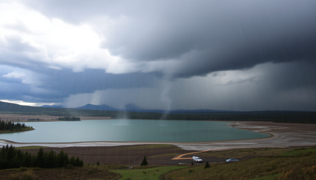
A calm lake doesn’t mean a calm region. On 11 February 2026, MetService issued an 11-hour heavy rain watch for Bay of Plenty that started at 2pm — conditions turned from fine to watch-level in less than a day.
MetService issues warnings only when conditions are expected to be severe or disruptive, not for routine rain. That’s why a 0.7mm day in Rotorua can coexist with a 90–130mm warning a short drive away.
What this means: regional rainfall in New Zealand is local to the point of being neighbourhood-specific — so the forecast for your street beats the regional average every time.
How bad is a red rainfall warning?
A red warning is the top of MetService’s public alert scale for severe weather. The agency classifies severe weather warnings as either Orange or Red, and Red is reserved for the most extreme events (MetService warnings and information). Most warnings issued in New Zealand are Orange, not Red — so when Red appears, the system is telling you this is unusual, dangerous weather.
What is a red rainstorm?
- A red rainstorm signal, used in some international warning systems, means heavy rain is likely to cause serious urban flooding.
- In MetService terms, a Red Warning implies widespread, sustained impact — not a passing shower.
What is a red thunder storm?
- Red thunderstorm alerts in some global systems mean severe storms with damaging winds, large hail, or intense downpours.
- New Zealand’s Red tier covers any severe weather type, including rain, wind, and thunderstorms.
Red-level alerts usually require immediate action rather than simple awareness. If MetService ever issues a Red Warning for Rotorua, treat it like a civil-defence instruction, not a forecast detail.
The pattern: Red warnings sit at the top by design — because by the time one lands, the environment is already in the middle of the event, not gearing up for it.
Which is higher, red alert or orange alert?
Red alert is the higher tier; orange is a step below. Both can be disruptive, but the two levels mean different things for your afternoon. Here is how the colour codes compare across systems, including the yellow and black labels people often ask about.
| Level | Primary meaning | Used by MetService? | Example in Bay of Plenty |
|---|---|---|---|
| Watch | Severe weather is possible; monitor forecasts | Yes | 11-hour heavy rain watch, Feb 2026 |
| Yellow alert | “Be aware” — low-end severe weather possible | No (watch plays this role) | Used in overseas community alert systems |
| Orange warning | “Take action” — disruptive weather likely | Yes | 90–130mm additional rain, June 2026 (MetService) |
| Red warning | Highest alert — extreme conditions, act now | Yes | Reserved for rare, high-impact events |
| Black rainstorm | Extreme rain, usually with serious flooding | No | Used in systems such as Hong Kong’s |
So while “orange alert” might sound milder than “red alert,” an orange warning is still serious. MetService issued orange warnings for the Bay of Plenty with 100–150mm totals expected in a day — enough to produce surface flooding and slips (MetService warnings).
What is meant by yellow alert?
- Yellow alert is the lowest tier in many global colour-coded weather systems; the general guidance is “be aware.”
- MetService doesn’t publish yellow alerts; its “watch” tier sits in that same alerting space.
Why this matters: knowing whether red beats orange isn’t trivia — it changes whether you clear the drains tonight or wait for the morning news.
Are we on yellow alert today?
As of MetService’s Rotorua forecast issued at 8:57am on 13 October 2026, the answer was no. The forecast described mostly low cloud with patchy drizzle, clearing temporarily in the afternoon, and a 95% probability of at least 1mm of rain — with just a 5% chance of reaching 10mm (MetService Rotorua forecast page).
- Rotorua had recorded 0.7mm and was expected to total 0.7mm for the day (MetService Rotorua forecast).
- The Bay of Plenty radar page showed one watch in its warning layer at that time (MetService Bay of Plenty radar).
- No active Orange or Red Warning appeared for Rotorua on MetService’s forecast page.
How can I check today’s warning status?
- Open the MetService warnings page and look for Bay of Plenty/Gisborne.
- Open the Rotorua 7-day forecast page for location-specific details.
- Check the Bay of Plenty radar loop for real-time precipitation context.
- For town-level detail, RNZ posts location-specific forecasts each day.
A quiet forecast can change quickly. If any band of heavy rain moves over the Kaimai ranges or the eastern Bay, a watch can upgrade to an Orange Warning within hours.
The trade-off: the current calm is exactly the time to build the habit of checking MetService warnings — because during an active warning, no one feels like browsing tabs.
How the warnings unfolded in 2026
Four moments define the heavy rain picture for Bay of Plenty and Rotorua this year.
- — Thunderstorm warning for BOP/Rotorua: 120–150mm expected, peak rates 25–40mm/h (MetService warnings).
- — MetService issued an 11-hour heavy rain watch for Bay of Plenty from 2pm Friday to 1am Saturday (MetService warnings).
- — Orange rain warning for BOP: 100–150mm expected, chance of 200mm in 24 hours (MetService warnings).
- — Orange Warning for Bay of Plenty east of Whakatane and parts of Gisborne/Tairāwhiti ranges: 90–130mm additional rain (MetService warning page).
- — Rotorua forecast shows no active warning (MetService Rotorua forecast).
The signal: heavy rain warnings in this region aren’t theatre. The June 2026 statement flagged rapid river rises, slips, and dangerous driving — the same hazards residents should expect whenever totals reach triple digits.
What we know and what’s still uncertain
Confirmed facts
- MetService issues Orange and Red severe weather warnings; Red is reserved for the most extreme events (MetService warnings).
- Severe rainfall warning criteria start at 50mm in 6h or 100mm in 24h over 1,000km² or more (MetService severe weather outlook).
- A June 2026 Orange Warning for parts of BOP/Gisborne forecast 90–130mm extra rain with peak rates up to 25–40mm/h (MetService warning statement).
What’s unclear
- Whether a black rainfall warning will ever be used in New Zealand — MetService currently uses only Orange and Red.
- Exact dates of a community-reported “Thursday and Friday” Rotorua heavy rain warning.
- Whether a yellow alert is active at the exact moment you read this; alert status changes quickly.
Why this matters: the confirmed list shows that MetService’s system is deliberately conservative — and the unclear list shows why you should check the live page instead of relying on yesterday’s news.
What officials and forecasters said
Two voices carry the most weight in a Bay of Plenty weather event: the official warning text and the town-level forecast. Here’s what each said.
Streams and rivers could rise rapidly. Surface flooding, slips, and difficult driving conditions are possible.
— MetService, Orange Warning statement for the region (June 2026)
That warning came with practical advice attached: clear drains and gutters, avoid low-lying areas, and drive cautiously (MetService warning page).
Mostly cloudy with morning low cloud or fog, light showers from late morning, clearing by evening.
— RNZ Rotorua town forecast, 13 October 2026
The contrast between those two statements is the whole story of Bay of Plenty weather: a region calm at the lake and storming an hour away; the pattern is that official warnings and local forecasts agree more often than they clash — but when they do, MetService’s version is the one to trust.
The 2026 warning trail across Bay of Plenty shows that Rotorua can sit in a quiet pocket while heavier rain fires nearby — and that orange, not red, is the level that most often tests the region. For anyone living between the lake and Whakatane, the habit that pays is checking MetService’s warning feed before the morning coffee: because 25–40mm per hour arrives much faster than a text message chain.
metservice.com, metservice.com, metservice.com, metservice.com
Frequently asked questions
What is a black rainfall warning?
A black rainfall warning is an extreme-weather alert used in some international systems, notably Hong Kong, where rainfall is expected to cause serious flooding. MetService does not currently use a black tier; its severe weather warnings are Orange or Red.
Where can I check the latest Bay of Plenty heavy rain warning?
The official source is the MetService warnings page, which lists watches, Orange Warnings, and Red Warnings for Bay of Plenty, Gisborne, and other regions. For Rotorua-specific detail, use the MetService Rotorua forecast page.
What should I do if a red rainfall warning is issued near Rotorua?
Treat a Red Warning as an instruction to act: avoid non-essential travel, stay away from low-lying areas and flood-prone streams, never drive through floodwater, and follow any civil-defence advice for your district.
How long does a MetService heavy rain warning stay in effect?
It stays in effect until the forecast threat passes; MetService can extend or lift warnings as conditions change. The February 2026 Bay of Plenty watch, for example, ran for 11 hours, from 2pm Friday to 1am Saturday.
Can Rotorua experience flooding during heavy rain warnings?
Yes. Bay of Plenty warnings in 2026 included surface flooding, slips, and rapidly rising streams as possible impacts, and Rotorua’s low-lying lakefront areas are vulnerable when intense rain combines with saturated ground.
What is the difference between a MetService watch and a warning?
A watch means severe weather is possible and you should monitor forecasts. A warning means severe weather is expected or already occurring and you should take action. MetService published both types for Bay of Plenty in 2026.
If you take one number from this page, make it 25–40mm/h — that is the downpour rate that turns a watch into a warning.
Related reading
More related posts
 Fisher & Paykel Top Loader: Problems, Lifespan & Review
 Doubtful Sound Overnight Cruise: Worth It? Guide & Reviews
 Mumbai Indians vs Chennai Super Kings: Dhoni & 2026 Rivalry
 St Johns First Aid Course – Essential Skills for Emergencies
 Pullman Auckland Airport Reviews: Is It Worth the Luxury?
 Taupo to New Plymouth: Driving, Flights, Bus & Best Stops
 Street Fighter Movie 2026: Cast, Release Date, and Updates