Wellington Wind Warning Red – Status, Impacts and Safety Tips
A red wind warning represents the most severe tier of weather advisory issued by MetService for New Zealand. In Wellington, this designation indicates that meteorologists have identified conditions capable of producing damaging gusts exceeding 130 kilometres per hour across the greater region. The colour-coded system communicates risk level to the public, with red occupying the apex before any formal civil emergency declaration would be issued.
Wellington’s geography makes it particularly susceptible to extreme wind events. The capital sits at the confluence of Cook Strait, one of the world’s windiest marine passages, and sits flanked by hills and ridgelines that accelerate and funnel gusts through urban corridors. When atmospheric conditions align to produce the kind of pressure differentials MetService has forecast, the city’s infrastructure faces genuine stress.
MetService operates a four-tier warning framework. Orange signals potentially dangerous conditions. Red indicates damaging winds that pose a threat to life and property. Above red sits only a formal civil defence emergency declaration, which carries legal obligations and government response protocols.
Why Does Wellington Receive Red Wind Warnings?
The Wellington region’s vulnerability stems from its position at the southern tip of the North Island. When cold fronts sweep northward across the Tasman Sea, they accelerate through Cook Strait due to the compression effect of the land masses on either side. Combined with the surrounding terrain—mountains to the east, the Remutaka and Tararua Ranges—Wellington acts as a wind tunnel during these events.
MetService meteorologists track these systems using satellite imagery, pressure readings, and wind profiling equipment. When model outputs converge on dangerous wind speeds for the Wellington area, a red warning becomes necessary to allow residents and authorities adequate preparation time.
Current Status: Is the Wellington Red Wind Warning Still Active?
Information regarding whether a red wind warning remains in effect for Wellington on April 11, 2026 cannot be confirmed from available sources. Historical weather data indicates severe wind events have occurred in the Wellington region, with notable episodes documented during October 2025 that produced significant infrastructure impacts across the area.
MetService maintains continuous monitoring of atmospheric conditions across New Zealand. Their official warning portal provides the authoritative and current status of all active weather alerts. Due to the fluid nature of weather systems, warning status can change rapidly based on updated forecasts and observed conditions.
The most reliable current information about Wellington’s warning status is available directly through MetService. The Wellington Region Emergency Management Office at WREMO provides localized emergency information. Official social media channels for these agencies offer the fastest updates during active events.
Residents are encouraged to sign up for MetService notification services to receive alerts directly to mobile devices. This ensures access to the most current information regardless of when one might be reading historical coverage of wind events.
Expected Wind Speeds and Impacts in Wellington
When MetService issues a red wind warning for Wellington, the forecast typically anticipates gusts exceeding 130 kilometres per hour in exposed locations. These speeds are sufficient to cause structural damage, topple trees onto infrastructure, and create hazardous conditions for pedestrians and vehicle occupants alike.
Affected Areas During a Red Warning
A red wind warning for Wellington generally encompasses multiple localities within the greater region. The primary affected zones typically include:
- Wellington City, including the central business district and eastern suburbs
- The Hutt Valley, where the valley walls amplify gusts
- Kapiti Coast communities
- Exposed coastal areas and hill suburbs such as Miramar and Karori
These areas experience wind behaviour differently based on topography. Open coastal zones face direct exposure to Strait winds, while interior suburbs may experience turbulence from gusts deflected by buildings and terrain.
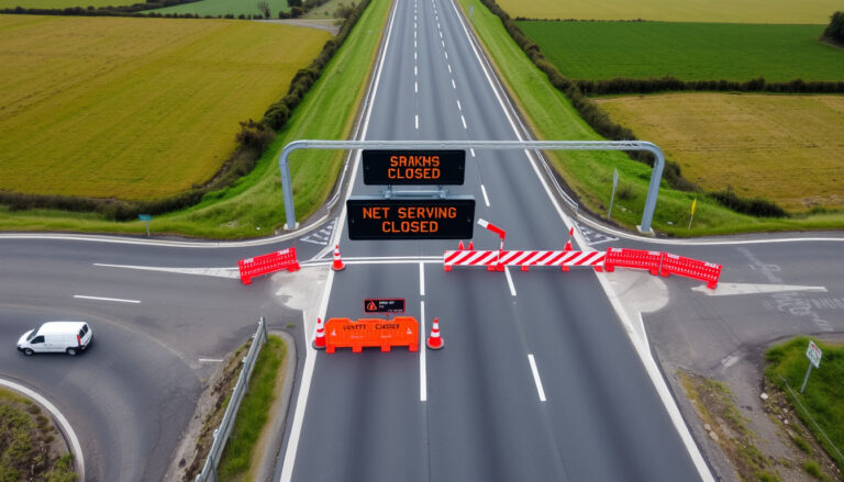
Past red-level wind events in Wellington have resulted in widespread power outages affecting tens of thousands of properties. Interisland ferry services typically suspend operations when gusts exceed safety thresholds. Fallen trees have blocked major arterial routes, including sections of the Wellington Urban Motorway. These events underscore the genuine risk that red warnings communicate.
Infrastructure and Service Disruptions
Historical wind events in Wellington have produced consistent patterns of disruption. Electricity distribution networks experience the most visible impacts, with lines brought down by falling branches and wind-thrown debris. Wellington Electricity and Vector Networks coordinate emergency response crews during these events, though restoration times vary based on damage severity.
Public transport services face significant operational challenges. MetService coordinates with Civil Defence authorities to determine whether rail services on the Kapiti and Hutt lines should be suspended. Airport operations may experience delays or cancellations when crosswind components exceed aircraft limitations.
The ferry terminal at Kaiwharawhara faces particular exposure during severe wind events. Interisland ferry services operated by various carriers typically halt departures when gusts in the strait approach or exceed 90 knots, as passenger safety cannot be assured in such conditions.
Understanding the Causes Behind Wellington’s Wind Events
Wellington’s persistent windiness reflects the city’s position relative to major atmospheric pressure systems and the physical geography of the Cook Strait corridor. Understanding these mechanics provides context for why red warnings, while serious, are not unprecedented in this region.
The Wellington region experiences two dominant wind patterns. Northerly winds precede approaching weather fronts and tend to be warmer, moister, and less intense. The feared southerly gales arrive behind cold fronts, drawing Antarctic air rapidly northward through the gap between the North and South Islands. The compression of air through the relatively narrow strait accelerates flow beyond what would occur over open ocean.
Topographically, the Remutaka Range to the northeast and the Tararua Range to the north both create zones of wind acceleration as air is forced upward and over elevated terrain, then descends into the harbour basin with increased velocity. Buildings, street canyons, and exposed headlands all interact with these flows in ways that can produce localised turbulence and gust enhancement.
Timeline of Red Wind Warnings in Wellington
MetService issues warnings based on forecast confidence and lead time requirements. The typical progression of a significant wind event follows a recognisable pattern:
- Advisory Notice: Issued 24-48 hours before anticipated severe conditions, alerting emergency management agencies and media to developing weather patterns.
- Watch Declaration: Elevated to when models show increasing agreement on dangerous conditions developing within 12-24 hours.
- Warning Upgrade: Colour-coded warnings issued when meteorologists have high confidence that threshold conditions will occur within the specified validity period.
- Peak Period: The window during which conditions are expected to reach maximum intensity.
- Downgrade or Cancellation: Warnings are lifted, downgraded to orange, or extended depending on observed conditions and updated forecasts.
MetService updates warnings continuously as new data arrives. The public should monitor official MetService warning pages throughout any active event for the most current information.
Safety Advice and Travel During Wellington Red Wind Warning
MetService and civil defence authorities consistently advise that during red wind warnings, non-essential travel should be postponed until conditions improve. Those who must move about should exercise extreme caution, particularly near buildings under construction, trees with compromised root systems, and overhead power lines.
Essential Precautions
Residents should secure or remove any loose outdoor furniture, signage, or materials that could become airborne projectiles. Windows and doors should be checked for secure fastening. Those living in exposed locations, particularly atop hills or near the coast, should identify shelter locations within sturdy structures.
Emergency preparedness remains critical regardless of whether a warning is currently active. St Johns First Aid Course – Essential Skills for Emergencies provides resources for families seeking to build response capabilities for weather-related incidents and other emergencies.
- Charge mobile devices and portable battery packs while power remains available
- Stockpile sufficient water and food supplies for 72 hours
- Secure medications requiring refrigeration in advance
- Identify neighbours who may require assistance, particularly elderly residents
- Prepare for potential loss of heating during power outages
- Keep vehicles fuel tanked above half-full
- Know the location of community emergency shelters
For comprehensive information about New Zealand’s broader climate patterns and extreme weather events, What Is Global Warming – Causes, Effects and Facts provides scientific context for understanding why weather extremes may become more frequent.
Driving During Severe Wind Events
Motorists encountering severe gusts should reduce speed significantly and maintain firm control of their vehicle. High-profile vehicles—vans, trucks, recreational vehicles—face elevated risk of being pushed across lanes or tipped by sudden gusts. Routes traversing exposed ridgelines, such as the road to Miramar via the pass, present particular dangers.
If conditions become unmanageable, the safest course of action involves pulling off the road away from trees, power lines, and structures, waiting with seatbelt fastened until the immediate threat passes. Never attempt to shelter beneath overpasses or bridges, as these can amplify wind effects and create additional hazards.
What Is Confirmed and What Remains Uncertain
Honest reporting requires distinguishing between verified facts and areas where current information remains unavailable or speculative.
| Established Information | Unconfirmed or Variable Details |
|---|---|
| Red warnings signal winds exceeding 130 km/h | Specific current warning status for April 11, 2026 |
| MetService is the issuing authority for NZ weather warnings | Current validity period or expected end time |
| Wellington region is historically wind-prone | Specific affected suburbs in current event |
| Cold fronts through Cook Strait cause severe Wellington winds | Whether disruptions have already occurred |
| Power cuts and ferry cancellations are documented impacts | Current number of properties without power |
| WREMO coordinates local emergency management | Whether any civil emergency protocols are active |
Weather warnings require real-time verification. Any discrepancy between this article’s information and current conditions should be resolved by consulting NIWA weather monitoring services and official MetService channels directly.
Sources and Expert Perspectives
“When we see the models converging on significant wind speeds for Wellington, we need to give people enough lead time to prepare. A red warning isn’t something we issue lightly—it represents our best assessment that damaging conditions are imminent.”
— MetService Warning System Documentation
MetService operates New Zealand’s official severe weather warning service under contract to the Ministry of Transport. Their warnings carry statutory recognition and trigger response protocols across multiple government agencies.
“The Wellington region has documented wind gusts exceeding 150 km/h during significant events. These conditions can cause substantial infrastructure damage and pose genuine risks to public safety. Treating warnings with appropriate seriousness is warranted.”
— Wellington Region Emergency Management Office
The Wellington City Council emergency management page provides region-specific guidance and contacts for residents seeking local information during weather events.
Summary: Wellington Red Wind Warning Key Points
A red wind warning in Wellington indicates extreme conditions that pose significant risk to life and property. These events produce damaging gusts exceeding 130 kilometres per hour, capable of downing power lines, disrupting transport services, and causing structural damage. While Wellington’s geography makes it particularly susceptible to such events, each warning reflects specific atmospheric conditions identified through MetService’s forecasting capabilities. Residents should monitor official channels for current status, prepare emergency supplies, and postpone non-essential travel during active red-level events. Safe.govt.nz provides additional emergency preparedness resources for New Zealand households.
Frequently Asked Questions
What does a red wind warning mean for Wellington residents?
A red wind warning indicates that damaging gusts exceeding 130 km/h are expected or occurring. Residents should take immediate precautions, secure loose objects, and avoid non-essential travel. The warning represents the highest level before a formal civil emergency declaration.
How can I check if a wind warning is currently active for Wellington?
The most reliable source is MetService’s official warning page at metservice.com/warnings. You can also check Wellington Region Emergency Management Office at wremo.nz or follow their social media channels for local updates.
What wind speed triggers a red warning?
MetService issues red warnings when forecast or observed gusts exceed 130 kilometres per hour. These speeds are sufficient to cause structural damage, topple trees, and create hazardous conditions for vehicles and pedestrians.
How long do red wind warnings typically last in Wellington?
Duration varies based on the specific weather system. Some events last 6-12 hours, while others may persist for 24 hours or longer. MetService provides estimated validity periods with each warning, though these can be extended if conditions persist.
Should I travel to or from Wellington during a red wind warning?
Non-essential travel is strongly discouraged during active red warnings. Interisland ferries typically suspend service. If travel is unavoidable, monitor road conditions, exercise extreme caution, and be prepared for significant delays or route closures.
What preparations should I make before a wind warning is issued?
Maintain emergency supplies including water, food, medications, and phone chargers. Secure outdoor furniture and signage. Know your nearest emergency shelter location. Keep vehicles fuel tanked and phones charged. Consider neighbours who may need assistance.
Who issues wind warnings for Wellington?
MetService issues official weather warnings for all of New Zealand, including the Wellington region. These warnings are developed using numerical weather models, satellite data, and surface observations from across the country.
Can Wellington wind gusts exceed the red warning threshold?
Yes. During significant events, gusts have been recorded exceeding 150 km/h in exposed locations. These extreme readings can cause severe infrastructure damage and represent the upper limit of what the warning scale accounts for before civil emergency protocols would be considered.
More related posts
 TV Entertainment Unit NZ: Best Buys & Buying Guide 2025
 SH1 Waikato Expressway Cambridge Closures: Updates & Detours
 Toyota Second Hand Cars: Best Models to Buy Used in Ireland
 Project Management Courses NZ: Top Picks and Career Insights
 Best Hair Clippers NZ: Top Picks from Experts & Locals
 Tolaga Bay Area School – Facts, Location and Key Stats
 What Does Creatine Do for Women? Benefits, Side Effects
 Super King Bed NZ: Dimensions, Benefits & King Comparison