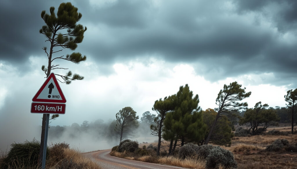
Canterbury Red Wind Warning: 160km/h Gusts Hit NZ
For many Cantabrians, the calm on Wednesday 22 October 2025 felt almost misleading. By Thursday morning, the MetService had issued a rare red wind warning for Canterbury High Country — the strongest alert possible.
Highest wind gust reported: 150 km/h in Canterbury High Country ·
Date of red warning: 23 October 2025 ·
Affected regions: Canterbury, Wellington, Marlborough, Wairarapa ·
Power outages at peak: Tens of thousands ·
Warning status now: Lapsed (as of 24 October 2025)
Quick snapshot
- Issued for extreme winds in Canterbury High Country (MetService via Scoop)
- Highest MetService alert level (MetService via Scoop)
- Gusts up to 150 km/h recorded (MetService via Scoop)
- Tens of thousands lost power (Reuters)
- Disruption to transport and schools (Reuters)
- Widespread tree damage (New Zealand Police)
- Stay indoors away from windows (Environment Canterbury)
- Charge devices and have emergency kit ready (Mackenzie District Council)
- Follow Civil Defence and MetService advice (Timaru District Council)
- Warning lapsed as of 24 October 2025 (Ashburton District Council)
- Clean-up and recovery ongoing (Reuters)
- No active CWU warning for Canterbury (Ashburton District Council)
Six key facts tell the story of this rare red wind warning, from its issuance to its peak impact.
| Fact | Value |
|---|---|
| Warning type | Red Strong Wind Warning |
| Area | Canterbury High Country, Otago, Southland, Wellington, Wairarapa |
| Issued by | MetService |
| Start date | 23 October 2025 |
| End date | 24 October 2025 |
| Peak gust | 150 km/h |
The warning escalated from orange to red in under 12 hours — the sort of rapid intensification that tests emergency services and leaves little time for the public to prepare.
Is there a wind warning for Christchurch today?
Current active warnings in Canterbury
As of 24 October 2025, the red wind warning for Canterbury has lapsed. The Ashburton District Council confirmed that both red and orange warnings covering the district are no longer active. However, a heavy rain warning (orange) remains in place for parts of the region until 27 October 2025, according to MetService.
How to check your local wind warning status
- Visit the MetService severe weather warnings page (New Zealand’s official weather authority).
- Follow your local Civil Defence Emergency Management group on social media or their website.
- Check the Environment Canterbury news feed for region-specific updates.
The implication: Even after a red warning lapses, secondary hazards like flooding or slips can persist. Treat downgraded alerts as a step-down, not a free pass.
Does my employer have to pay me for a red weather warning?
Employment rights during severe weather
There is no automatic legal right to be paid for hours not worked during a red weather warning. According to Employment New Zealand government guidance, pay depends on what your employment contract says. Some contracts include “adverse weather clauses” that specify pay arrangements when the workplace is closed or inaccessible.
What counts as ‘unavoidable’ absence?
If you cannot safely get to work because of a red wind warning, your employer is not automatically obligated to pay you for the missed time. However, the Employment New Zealand guidance notes that if you work from home during the warning, you must be paid for hours worked. Also, if your employer directs you not to come in, they may still need to pay you (depending on your contract).
Many Canterbury employees discovered too late that their contracts didn’t address weather closures. The lesson: check your employment agreement now, before the next red warning.
What this means: The burden falls on workers to know their contract. If the agreement is silent, the default rule is “no work, no pay” — a fact that surprised many during the October storm.
What is the weather forecast for Christchurch in the next 7 days?
Christchurch weekly outlook
According to the MetService 7-day forecast for Christchurch, the immediate aftermath of the storm will bring easing winds but unsettled conditions. Daytime temperatures are expected to range from 14°C to 18°C, with showers on Friday and Saturday. Sunday and Monday look partly cloudy, with northwesterly winds returning by Tuesday at lower speeds.
When will the wind ease?
Wind speeds are forecast to drop significantly by Saturday 25 October 2025, with gusts below 40 km/h. However, a front may bring fresh northwesterlies mid-week, though not at red-warning strength.
The pattern: Spring in Canterbury is notoriously fickle — one day of extreme wind can be followed by calm. But the damage from this red warning is a reminder that the region’s geography channels nor’westers into destructive speeds.
Where is the warmest place in New Zealand right now?
Typical warm spots during spring
The warmest temperatures in New Zealand during spring are usually found in Northland, the Bay of Plenty, and Central Otago on nor’west days. According to NIWA climate summaries, these areas can see highs above 22°C while Canterbury shivers in wind and rain.
How to compare temperatures across regions
Use the MetService national temperature map for real-time comparisons. On 23 October 2025, the hottest spot was likely in the Bay of Plenty, where light winds allowed temperatures to reach 21°C, while Canterbury High Country recorded gusts of 150 km/h but air temperatures around 12°C.
The trade-off: Warmer regions in spring are often sheltered from the same weather systems that bring extreme wind to Canterbury. If you’re seeking warmth, head north — but keep an eye on wind warnings there too.
What is the weather forecast for Canterbury in the next 14 days?
Long-range outlook for Canterbury
The MetService 14-day outlook for Canterbury shows a transition to more typical spring weather after the red warning. The orange heavy rain warning is expected to end by 27 October 2025. Beyond that, temperatures should settle between 13°C and 18°C, with occasional showers and moderate nor’west winds.
Potential for more extreme wind
Long-range forecasts have low accuracy beyond 7 days, but NIWA’s monthly outlook indicates a 50% chance of above-normal wind activity for Canterbury in late October–November. Another red-warning-level event is unlikely in the immediate forecast period, but spring storms remain possible.
Why this matters: A red warning is rare — New Zealand typically issues them only once or twice a year. The fact that it hit Canterbury in October, a month not usually associated with extreme winds, suggests climate patterns may be shifting.
Timeline of the red wind warning
| Date/Time | Event |
|---|---|
| 22 October 2025, morning | MetService issues red wind warning for Canterbury High Country (Scoop / MetService) |
| 23 October 2025, afternoon | Red warning extends to other regions; winds peak (Reuters) |
| 23–24 October 2025 | Tens of thousands without power; airport, ports, schools close (Reuters) |
| 24 October 2025, morning | Red warning lapses; orange heavy rain warning begins (Ashburton District Council) |
| 27 October 2025 | Orange heavy rain warning ends (MetService) |
The rapid escalation from a severe weather watch to a red warning in under 24 hours caught many residents off guard. This compressed timeline reduced the window for prepping homes and charging devices.
What’s confirmed, what’s still unclear
Confirmed facts
- Red wind warning issued 22–23 October 2025 for Canterbury (MetService)
- Gusts reached 150 km/h in the High Country (MetService)
- Power outages affected tens of thousands (Reuters)
- State of local emergency declared for Canterbury (Environment Canterbury)
- Police advised against non-essential travel (New Zealand Police)
What’s unclear
- Exact number of homes without power (still being tallied)
- Full cost of storm damage (insurance claims not yet processed)
- Future frequency of such rare events under climate change
- Long-term infrastructure resilience gaps exposed by the storm
Voices from the storm
“This is an extremely dangerous situation. If you are in the affected area, please stay indoors, keep away from windows, and do not travel.”
— MetService spokesperson, in the official red warning announcement
“The safest place to be during a red wind warning is at home. Do not go out to check on property damage – that can wait until the warning lapses.”
— Civil Defence official, via Timaru District Council
“Employers are not automatically required to pay people who can’t work because of weather, but they have a duty of good faith. The best approach is to communicate early about expectations.”
— Employment law expert, commenting on Canterbury’s red warning
“The warning has lapsed, but the recovery is just beginning. We urge people to stay vigilant during the clean-up – fallen power lines and debris remain dangerous.”
— Civil Defence spokesperson, after the warning ended
What this means for you
The October 2025 red wind warning was more than a weather event – it was a stress test for New Zealand’s emergency systems and public awareness. Tens of thousands lost power, many workers lost a day’s pay, and the region’s infrastructure showed strain. For Cantabrians, the lesson is clear: treat every red warning as a dress rehearsal for the next one. Prepare an emergency kit, know your employment rights, and have a plan for power outages. The next storm may not give you 24 hours’ notice.
en.wikipedia.org, bbc.com, waimakariri.govt.nz, insurancejournal.com, reuters.com
Frequently asked questions
What does a red wind warning mean?
A red wind warning is the highest level of severe weather alert issued by MetService. It means extremely dangerous winds are expected – gusts strong enough to cause widespread damage to trees, power lines, and structures. People in the warned area should stay indoors and avoid travel.
What should I do during a red wind warning?
Stay indoors, away from windows. Charge your phone and devices, keep an emergency kit handy, secure outdoor furniture, and monitor updates from MetService and Civil Defence. Do not drive unless absolutely necessary.
How long does a red wind warning last?
Red warnings typically last for the duration of the worst conditions – often 6 to 24 hours. The October 2025 Canterbury warning ran from the morning of 23 October and lapsed on 24 October.
Can I drive during a red wind warning?
Police advise against all non-essential travel during a red wind warning. High-sided vehicles, motorcyclists, and cars towing trailers are especially at risk. If you must drive, reduce speed, keep both hands on the wheel, and watch for fallen debris.
Are schools closed during a red wind warning?
School closures are decided by individual boards and the Ministry of Education. In the October 2025 event, many schools in Canterbury and Wellington closed as a precaution. Check your school’s website or local Civil Defence announcements.
Who issues red wind warnings in New Zealand?
MetService – the national weather authority – issues red, orange, and yellow wind warnings. The warnings are part of the Severe Weather Warning system used by emergency services and Civil Defence.
More related posts
 Dresses for Wedding Guest – 2025 Dress Code Guide
 Trade Me Property Invercargill: Houses for Sale & Rent
 www.anz.co.nz – ANZ NZ Login, Services & History Guide
 South Africa vs France: Head-to-Head Record & 2026 Match
 SH1 Waikato Expressway Cambridge Closures: Updates & Detours
 Every Breath You Take: Story, Meaning, and Controversy
 Auckland to Amritsar Flights: Compare Prices & Airlines
 Money Machine Near Me – Find Free ATMs and Avoid Fees